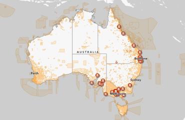
Today the department launched a new map showing local drone rules for parks and corrections institutions across Australia. Free and easy access to this information all in one place will help community understanding and industry or recreational flight planning. Greater awareness will support compliance with such environmental or security related laws.
This first release shows rules for 7,610 different areas managed by 15 different responsible authorities, with more cooperation planned for the future.
Note that drone users must follow CASA safety rules at all times.
The map has been developed as part of the Drone Rule Digitisation project, and over 18 months of collaboration between Commonwealth, State and Territory agencies.
The open, iterative and digital-first approach is fit-for-purpose in the digital drone ecosystem. The project is recognised in the Government’s Data and Digital Government Strategy, as it contributes to simple, secure and connected public services.
Check out the map to see what rules might be in place near you.


